Vantor has secured a follow-on contract worth up to $217 million to support the US Army’s One World Terrain program for training missions using high-precision 3D terrain.
Under the deal, the company will expand the initiative from prototype to full production, delivering a synthetic global environment to support large-scale training exercises.
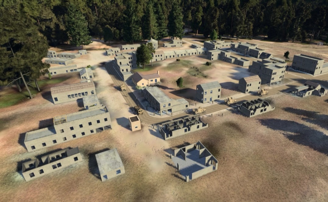
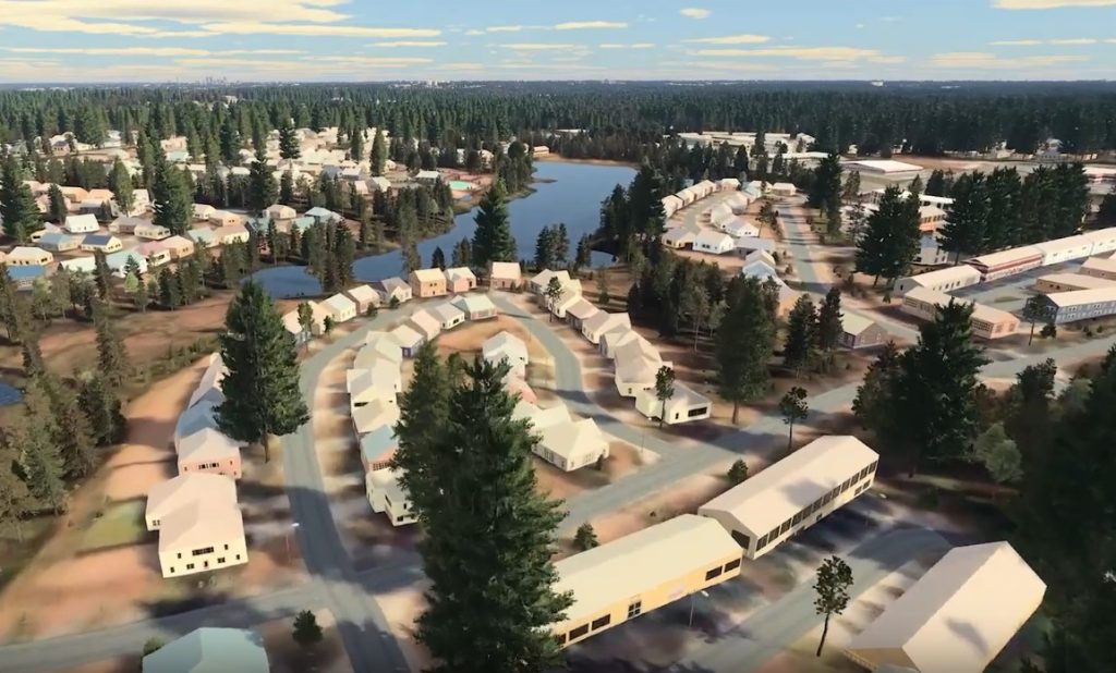
The terrain models provide immersive, texture-rich representations of Earth, enabling realistic mission rehearsal, operational planning, and collective training across a wide range of scenarios without the need for physical deployment.
Building on more than six years of prototype development, Vantor will use its 3D Vivid Terrain platform to produce ultra-realistic digital representations of global terrains.
The system combines AI-driven analytics with advanced 3D modeling tools and continuously integrates satellite and drone data through Vantor’s Forge fusion software.
Vivid Terrain covers more than 100 million square kilometers (about 38.6 million square miles), with an accuracy of 3 meters (about 10 feet) in all dimensions.
The models include real-world surface textures and vector representations of buildings and vegetation with height data, providing detailed geospatial information for training, planning, and operational analysis.
Latest Projects
Vantor continues to expand its footprint through a series of recent partnerships.
Earlier this month, the company partnered with CGI to develop next-generation spatial intelligence and navigation tools.
The effort combines AI analytics, edge computing, and visual processing with Vantor’s geospatial and GNSS-resilient navigation technology.
Last year, Aechelon Technology completed a proof-of-concept using AI and Vantor’s global 3D terrain data to convert ICEYE radar imagery into detailed synthetic environments.
The system fuses radar detection with Vantor’s continuously updated 3D maps, covering over 95 percent of Earth’s landmass, delivered via the Tensorglobe platform and supported by a satellite constellation that revisits the same area up to 15 times per day.