BlackSky has brought its third Gen-3 satellite into commercial service three weeks after launch, continuing a trend of shorter commissioning timelines compared with earlier deployments.
The latest Gen-3 satellite and the previous unit, launched in June, both reached first imagery within about 12 hours.
By comparison, the first Gen-3 satellite, launched earlier this year, delivered initial imagery five days after launch.
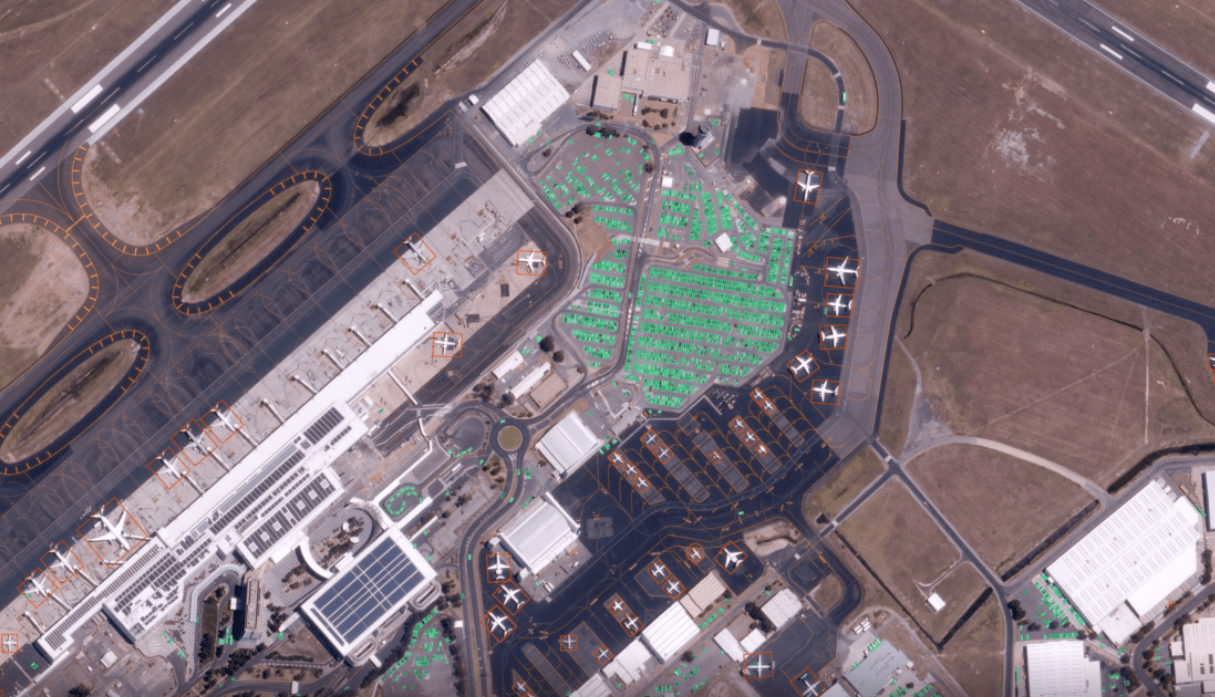
According to the company, bringing the third Gen-3 satellite into service increases BlackSky’s available capacity for very high-resolution imagery, with spatial resolution of up to 35 centimeters (14 inches).
“Customers no longer have to wait months to access capacity from newly launched on-orbit assets — timelines typically associated with traditional commissioning timelines,” the company emphasized.
BlackSky CEO Brian O’Toole stated that “with every successful Gen-3 performance milestone, BlackSky demonstrates that we are unequivocally meeting global demand for flexible, secure tactical ISR capabilities at unprecedented speed.”
All three Gen-3 satellites are now available to customers through BlackSky’s Spectra platform, which is used for satellite tasking, data delivery, and analytics.
The system supports frequent, time-diverse imaging during both daytime and nighttime operations.
It also provides automated detection of vessels, aircraft, and vehicles using AI-based processing.

Growing Capacity
BlackSky is expanding its satellite operations as demand for timely access to Earth observation data increases.
With three Gen-3 satellites currently in orbit, the company plans to add satellites at a regular pace to increase overall capacity.
Moreover, earlier this year, BlackSky announced plans to further expand its fleet with new multispectral satellites intended for wide-area data collection.
The Virginia-based firm is working with development partners and expects to begin launches in 2027.
The new satellites, known as AROS, are being developed to support applications such as national-level mapping, surveillance, and 3D digital modeling.