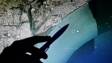
Maxar Intelligence has rebranded as Vantor and introduced Tensorglobe, an AI-powered spatial intelligence platform.
The move marks the company’s shift from a satellite imagery provider to full-spectrum spatial intelligence firm.
Tensorglobe combines data from satellites, aircraft, and ground sensors into a single system, producing a 3D model of the Earth with one-meter (3.3-feet) accuracy.
Read the full story on our new publication, Military AI: Maxar Rebrands, Launches AI Platform for Real-Time Geospatial Intelligence